Showing posts with label sxs touring. Show all posts

Monday, January 16, 2017

IMPORTANT PLANNING TOOL - FS Recreation Report Shows Current and Future Motorized/Non-Motorized Trends

Don Amador at BLM's Cow Mountain OHV Recreation Area
Northern California

In November 2016, the USDA/Forest Service released an important technical report entitled: Federal outdoor recreation trends: effects on economic opportunities.  QWR believes this 56 page document provides important information to recreation and trail advocates on current and future trends for both motorized and non-motorized recreation on federal lands between now and 2030.

LINK TO REPORT WEBSITE

The report states that between 1999 and 2009, nature-based outdoor recreation generally increased, although trends differ across individual activities. The number of U.S. participants1 in 50 nature-based outdoor recreation activities increased 7.1 percent between 1999 and 2009, while the number of activity days increased at least that much. Activities oriented toward viewing and photographing nature have been among the fastest growing activities, both in terms of number of participants and activity days of participation. Off-highway vehicle driving realized a 34-percent increase in participants. Several physically challenging activities, such as kayaking, snowboarding, and surfing also had relatively large increases in this timeframe.

ATV Use at Oregon Dunes


QWR agrees with the report’s conclusion that states a major challenge for public natural resource managers and planners will be to ensure that recreation opportunities remain viable and adapt to a changing population. This could be accomplished through more creative and efficient management of existing federal recreation resources.

QWR believes that improvements to existing recreation resources can include a wide range of management options such designating connector trails, improved signing and maps, creating new trail opportunities within developed OHV areas, improved legal connectivity and looped opportunity for new OHVs such as UTVs, and consolidation of federal lands where appropriate to provide new staging areas or trails.

Connector Route for SxS Use
Stanislaus NF

As various Forest Service and BLM units continue or start their resource management planning efforts, QWR believes it will be important for OHV clubs to arm themselves with good information as they prepare their public comments.  Your comments (including site-specific examples of where a current or new use should or could occur) will play an important role in development of those management plans.

This report contains a lot of good information (including charts and graphs) about current and projected recreation needs related to developed sites, dispersed opportunities, backcountry activities, motorized uses, hunting, fishing, water sports, and skiing.

Active participation by local OHV clubs is a critical element in the land-use planning process.  Now more than ever… you are in charge of your own trail riding destiny.


Monday, October 17, 2016

"Encouraged" ROV Use on Public Lands Requires Partnership

Colusa County Road Combined-Use Designation
(County Road Provides OHV/ROV Access to Federal Route Network)

As the popularity of Recreational Off-Highway Vehicle (ROV) -- which is sometimes called a Side x Side (SxS) or Utility Trail Vehicle (UTV) -- recreation continues to grow in the country, it creates a need for land managers to ensure (on units that have potential ROV opportunities) their OHV program includes ROV-related travel management information and legal access to designated roads and trails where said use is appropriate.

In addition, travel management has become highly complex and even political since many federal OHV route networks depend on city, county, or state roads (both paved and natural surface) for campground/staging area access or connectivity.

Plumas County Non-Highway Designation for OHV/ROVs
(County Dirt Roads Provide Connectivity between Federal Route Network)


Some states have laws that classify ROVs via a legal description which then dictates which routes are open based on vehicle type.  Helmet law requirements for ROV use can also differ from state to state.

ROV/ATV Helmet Law Sign
(Mendocino National Forest in California)

QWR understands that public land agencies often don’t have the fiscal or human resources to construct new ROV specific trail opportunities.

However in the meantime, OHV program managers can review their route network and camping opportunities to see where road/trail reclassifications or designations can be made to create legal ROV opportunities.

New ROV Access Route from Campground
(Hull Creek Campground, Stanislaus National Forest)


ROV users also have a role to play in helping enhance the functionality of the existing route network.  They can help identify where a road/trail segment needs to be reclassified or redesignated for ROV use (i.e. level 3 road to level 2 road or road to primitive road, etc.) ROVers can also suggest where appropriate loop or destination opportunities might exist.   Those opportunities could be part of an “encouraged” ROV route network.

Discovery Point Along OHV/ROV Tour Route
(BLM's Chappie Shasta OHV Area)

Local ROVers have an important role in helping create political support in areas where county or state roads provide connectivity between federal recreation facilities such as trails and campgrounds.

QWR commends the land managers and local ROV groups who have created partnerships to designate fun and exciting opportunities.

Backcountry ROV Adventure
(BLM's Carson City Field Office - Pine Nut Mountains, NV)


QWR believes that current and future high quality ROV recreation on public lands will rely on a substantive working relationship/partnership between the public and private sectors.


Tuesday, October 11, 2016

Passion for Trails and Public Service Highlight Sierra Interagency OHV Workshop

Campground OHV Access Trail to Adventure on the
Stanislaus National Forest

Cooler weather and spectacular scenery welcomed about 35 attendees to the 2016 Ranger Ride and OHV Workshop held on October 4-6, 2016 at the Hull Creek Campground. This annual interagency trail management event was coordinated by Don Amador of Quiet Warrior Racing (QWR) and the BlueRibbon Coalition/Sharetrails.org (BRC). The event was hosted by the Mi-Wok Ranger District on the Stanislaus National Forest. 

The group included OHV managers, trail specialists, line-officers, instructors, recreation staff, law enforcement officers, public affairs, field crew members, and private sector partners from the Eldorado National Forest, Sequoia National Forest, Stanislaus National Forest, Tahoe National Forest,  BLM Eagle Lake Field Office, BLM Redding Field Office, BLM Ukiah Field Office, BLM CA State Office, CA State Parks OHMVR Division (OHMVRD), BlueRibbon Coalition/Sharetrails.org, Quiet Warrior Racing, Stewards of the Stanislaus National Forest, and Trails Unlimited LLC.

Topics and modules included trail rides, demonstrations, dirt-bike certification and recertification courses, and exchanging OHV management strategies/challenges/successes.

Mi-Wok District Ranger, Fred Wong, Welcomes Group

After the welcome by Mi-Wok District Ranger, Fred Wong, and other Forest staff, an overview of OHV recreation on BLM land in CA was given by the BLM State Office Trail lead, Jane Arteaga.

Brian Robertson, OHMVR Division Chief, also gave the group an update on the CA State Park Transformation Process and how it recognizes the important relationship that exists between the CA OHV Program and its federal partners.

OHMVRD Chief, Brian Robertson, Talks about State OHV Grant Program
that Funds Restoration and Trail Projects on Federal Lands


Attendees then broke up into several groups to either take the Motorcycle Safety Foundation’s DirtBike School or participate in a walking tour to review the 15 year evolution of various restoration, signing, and armoring projects implemented to protect natural resources and preserve continued OHV access to the Hull Creek Campground.  

Paul Hart, a certified DirtBike School coach and Trails Manager for the Yuba River Ranger District on the Tahoe National Forest, taught this one-day hands-on training session, over the course of two days, to agency students from the Forest Service, BLM, and OHMVRD.  Students learned basic riding skills, trail ethics, and environmental responsibility.  

FS Trail Staff Enjoys Dirt Bike Tour of Designated 
Road and Trail System

After graduation from the course, students took part in easy and moderate trail rides lead by agency staff and local volunteer partners. This allowed the students to improve and practice the skills taught during the DirtBike School.   QWR strongly believes that post-class mentored trail rides where new riders get extra seat time to further hone their skills is a vital aspect of the training program.

Hull Creek Campground Restoration Project

The upgrades to Hull Creek Campground are a good illustration of how a pro-active “all-hands” holistic approach to managing OHV facilities can be successful in protecting important natural/cultural resources  while providing continued public access to a high quality camping and riding experience.

Campground Tour Includes Stop at Recent Tread Block
Armor Project

The many Hull Creek Campground improvement project partners include; OHMVR OHV Ground Operations Grant funding, American Conservation Experience Crews (ACE), CA Conservation Corps (CCC), Merced Dirt Riders, and Summer of Success High School Crew funded by Tuolumne County RAC and administered by Mother Lode Job Training.


OHMVRD LE, Kim Baker, Takes Turn on Kubota Trail Tractor

The workshop wants to thank Scott Kuhlwein from Garton Tractor for providing the event with a demo Kubota subcompact tractor/backhoe so event participants could practice on this popular piece of trail equipment.  These sub-compact tractors are used on the Stanislaus National Forest and other units to perform various trail maintenance and construction projects.

FS Trail Staff Illustrate Trail Tread Block Installation

Later in the day, folks worked on a tread block project to armor a trail grade against erosion from dirt-bikes and ATVs.

BLM's, Jane Arteaga, and Don Amador at
 Tread Block Demo

Another group went on a trail ride to review the ongoing efforts by the local trail specialists to provide a high quality and sustainable trail program for riders that visit this destination OHV area in the Central Sierra.

Trail Rides/Tours of Designated Routes

Day two started off with a presentation of the Forest’s travel management signing strategy.  The unit’s trail staff believes that an effective signing program is one of the most important methods of conveying (to the public) its commitment to managing sustainable OHV recreation.

Travel Management Signs at Hull Creek OHV Area

QWR believes that signs are an important form of communication in showing the public where they can ride on designated roads, trails, and areas.  Effective signing programs may also consist of a complex system of alternative “signs” that can include border fencing, maps, public education, the appropriate level/type of law enforcement, trail delineators, and vehicle parking restrictors.

Low Profile "Signs" to Stay on Designated Trails

QWR believes the quality of an agency’s signing program is directly proportional to the rate of user enjoyment, public compliance with regulations, and success of the unit’s mission, vision, and values.

OHV Info in Hull Creek Campground

QWR commends the Stanislaus National Forest for its implementation of a holistic signing program that uses the minimum level of “signs” needed to meet its management goals and objectives.   The unit uses adaptive management to adjust its signing prescriptions as appropriate.

Example of Well Signed OHV Trail in Hull Creek Area 

The greater Hull Creek OHV Area is home to a number of waterways including Hull Creek, Trout Creek, and the Clavey River.

Restoration Project in Trout Creek Watershed

The Forest took a number of participants on a tour of its rather impressive and substantive restoration efforts in the Trout Creek watershed.  Those numerous water quality and resource/cultural protection projects included installation of rock barriers, restoration signs, and route delineators.

Restoration Project in Clavey River Watershed

Joe Chavez, Tahoe National Forest Trail Lead, gave an update and field demonstration of the R5 Wet Weather Soil Studies.   Chavez demonstrated the procedure and stated they might do a pilot project soon at one of their riding areas on the Tahoe National Forest.

Tahoe National Forest Trail Lead, Joe Chavez, Takes
Soil Moisture Reading

According to a previous QWR article by Roger Poff (lead scientist on the project), the Forest Service has been conducting field studies to develop an evidence-based method for opening trails based on direct measurements of trail condition.

The field studies involved measuring soil strength and soil moisture, and correlating those measurements with observed levels of trail damage. The information is used to predict the risk of trail damage at different levels of soil strength and soil moisture. This prediction of risk can then be used to develop threshold values to determine when to open or close trails.

Chavez demonstrated the procedure and stated they might do a pilot project soon at one of their riding areas on the Tahoe National Forest.

QWR believes it will be an important tool in the trail manager’s toolbox for managing trails under wet conditions.

A good “campfire” discussion broke out on the topic of managing trail/route opportunities for SxS recreationists.  With the demand for backcountry SxS touring opportunities growing each year, the group felt it is important for units - that have the capacity to provide for SxS recreation - to look for ways to adjust their travel management strategies to accommodate said use.

Campground Access Route for Dirt-Bikes, ATVs, and SxSs

Often that can include making sure that SxSs have legal access from campgrounds and staging areas to backcounty touring or destination type experiences.  Units should also consider reviewing their existing trail/road networks to identify “encouraged” route opportunities for ½ or full day excursions.

Historic Bourland Train Trestle - A Potential OHV/SxS Destination Site

Another discussion related to travel management on Forest Service lands included the concept of the agency reviewing how its level 3 (usually not open for non-street legal OHVs) road system is integrated into it overall OHV travel program. 

Level 3 roads can often provide important connectivity between motorized trails/level 2 roads for non-street legal OHVs.  Where connectivity is critical for a high quality OHV recreation experience, agency units should consider mixed-use designations for level 3 roads or administratively reclassify the level 3 road to a level 2 which then can be used by non-street legal OHVs.

Example of Mixed Use Sign on the Mendocino National Forest
  
At the conclusion of the event, it seemed the participants appreciated the education modules, dirt-bike training/certification, opportunities for networking and relationship building, and the effort made to include a lot of “seat time” for trail riding.

Mi-Wok District Recreation Officer, Chuck James, Gets Ready to Lead Trail Ride 


Finally, QWR appreciated that RZ Mask sent some demo dust filtration masks to the event.  Fitting under the rider’s helmet, those masks really helped filter dusk on several of the longer trail rides and added a much appreciated level of comfort for the participants.

Don Amador with RZ Mask

A big note of gratitude goes out to our agency and volunteer partners who helped make this event a fun and informative learning experience.  Once again, this annual workshop proves there is no substitute for “getting out in the field or on the trail.”

Trail Delineator with Wire Strand Deterrent to Discourage
Cutting with Chainsaw

The main takeaway from the event for QWR was the participant’s passion for trails and public service.  It was evidenced by the smiles on their faces and the management prescriptions they have implemented over the last decade to preserve and protect natural/cultural resources while providing continued access to high quality OHV trail-based recreation.

# # # 

Wednesday, July 8, 2015

BREAKING NEWS - NEW "GREEN STICKER" SXS/ATV BACKCOUNTRY TOURING ROUTES IN NW CA


Forest Road 17N40

With the demand for backcountry OHV touring opportunities growing each year, QWR wants to highlight several NEW SxS and ATV riding options in Del Norte County on public lands within the Smith River National Recreation Area (NRA) on the Six Rivers National Forest.

View from CR 405 

The NRA is unique since the county road network functions as the only connector route for many of the designated Forest Service level 2 roads and trails. 

Forest Road 18N17 at CR 316 Intersection


Over the last few years, BRC, QWR, and the CA OHMVR Division, has been working with Del Norte County Supervisors and planning staff on ways to enhance legal OHV recreation in the Smith River area.  Those efforts were largely centered on the county designating 82 miles of their non-paved county roads as “non-highways” pursuant to CVC Section 38001.  Those non-highway designations were made by the county in November 2014.

CR 405 Mile Marker

 
2014 Del Norte County Non-Highway Resolution

If you have not ridden in this remote part of California, you are missing a real adventure that takes you back in time to when many of these routes were primary access roads in the 1800s.  This area has a rich mining history.

Old Gunpowder Magazine

The NRA is also home to many streams and much of the Smith River which is a prize fishing stream during the late summer and fall seasons.  During the hot summer months, many of these waterways have great swimming holes where you can cool off after a long days ride.

County Roads 314, 315, 316 Loops

For those who might be interested in taking a SxS or ATV adventure tour of this area, QWR would like to offer some suggestions for the northern loop which goes into Oregon and then back into California.

Patrick Creek Lodge

A great staging area(s) for several days of riding is at Patrick Creek Lodge where they have comfortable rooms and great dining.  If you want to camp, there is the Forest Service Patrick Creek Campground just across the highway from the lodge.  A refreshing swimming hole is close by for that after ride cool down.


Just across the bridge from the lodge, there is Patrick Creek Road (County Road 316 – Pink).  There is a staging area just across the bridge but there is a larger day staging area about 1 mile up the road on the left.  Also, there are numerous dispersed campsites along the creek.

Patrick Creek Campground


Follow CR 316 north to Forest Road 18N17 (Yellow) and ride out to the end of Monkey Creek Ridge (18N17 is seasonally open June 15 to October 15). Come back out to CR 316 and take a right and head north until you T into Forest Road 4402 (Blue).  Turn left on 4402 for a few miles and watch for a 4402 carsonite sign on the left.  Go left and you will be on the Wimer Road.

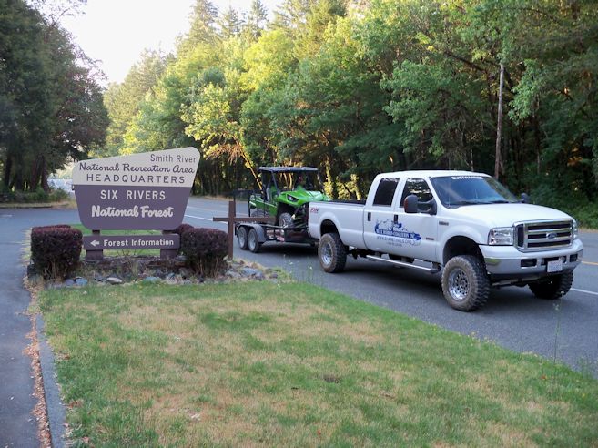
NRA District Ranger (L), David Palmer, Reviews Map of Area
with Local OHV Leaders

Forest Road 4402 is in the Rogue-Siskiyou National Forest.  QWR has confirmed with the Forest that the “blue” portion of 4402 is open for OHV use. 

FS Road 4402 to Diamond Creek/Wimer Road


The Wimer Road is a rocky 4WD route that will take you past Forest Road 18N09 (Diamond Creek – Yellow) and over to CR 305.  The 305 will take you past some great views of the mountains and the coast.  When on the 305 don’t forget to stop at the Stone Corral and enjoy what used to be a resting point for wagon trains and stage coaches.

Wimer 4WD Road

Another trip for your SxS or ATV is the French Hill/Hurdygurdy Creek loop which consists of CR 411 and 405.  QWR recommends that you stage from the Big Flat area where there is a large parking area.  The Yellow Routes are FS level 2 roads open for OHV use.

Wild Azalea

Both areas contain many vistas and potential dispersed camping opportunities.  Set aside plenty of time to explore the country.

Old Stone Corral

It is important to remember that the NRA is still waiting for the Record of Decision (ROD) on the newest round of travel management to be published sometime later this year.  QWR and others are hopeful that it will include additional OHV routes that will complement the county non-highway road system. The county is also working to enhance its signing program.

View of Lake Earl from CR 305

Be sure and stop by the Gasquet Ranger Station and pick up the most recent MVUM.

NRA Ranger Station

If you would like higher resolution PDF files of the two areas, please send a request to: damador@quietwarriorracing.com