Thursday, August 20, 2015

Archeological Site Stewardship Training is Valuable Trail Tool


The evolution of a well-trained and multi-disciplined volunteer OHV trail workforce is both impressive and important.  In the 21st Century, it has become a critical tool and force-multiplier for land management agencies to utilize in taking care of recreation facilities.

In many areas, highways, roads, and OHV/OSV trails overlay historic routes used by Native Americans and early pioneers to travel cross-country or for trading goods and services.  Because of their history, these trails and nearby areas have significant archeological value.

Kyburz Petroglyph Open to the Public

  
Three good examples of historic pioneer routes are the world famous Rubicon Trail, the Mormon Emigrant Trail, and the Henness Pass (Kyburz) Trail.  Segments of said routes provide important OHV and/or OSV opportunities.


LINK TO HENNESS PASS/KYBURZ PETROGLYPH INFO/MAP

QWR believes that trail volunteers have an increasingly important role to play in assisting Forest Archeologists as stewards to monitor cultural sites.  Trail volunteers are equipped to travel long distances and can access remote archeological sites under supervision by the Forest Archeologist.

Recently, Don Amador took the California Archaeological Site Stewardship Program (CASSP) Volunteer Workshop held on the Eldorado National Forest.  QWR believes this training is important for engaged trail volunteers because it expands their ability to assist the agency in managing OHV recreation as it relates to protecting archeological resources.


The volunteer training is managed by CASSP.  It received a 2014/2015 grant from the California OHMVR Division because it is an innovative partnership program designed to assist federal land management agencies balance the statutory requirements to protect cultural resources with their responsibility to sustain long-term OHV opportunities on public lands.

Through services provided by CASSP volunteers, agencies have been able to maintain OHV opportunities that would have been restricted in order to protect cultural resources. CASSP training workshops and CASSP volunteers also help agencies to educate the public about environmental responsibility, safety, and respect for private property. CASSP has become a critical element in conserving significant historical and prehistoric cultural resources.

According to the grant application, CASSP workshops and volunteers enhance existing OHV opportunities in three ways: helping to keep trails open, improving the visitor experience by providing information about the prehistory and history, and increasing communication, education, and understanding among different groups.

Historically, the management response has often been to close trails or restrict OHV opportunities. By monitoring and protecting archaeological and historical resources, CASSP helps maintain a balance between protecting cultural sites and responsible OHV recreational use of trails and OHV areas. Also OHV site stewards serve as role models and inform other off-highway vehicle users to follow the designated trails, ride responsibly, and remember to ride safely. As a result, the cultural resources, agencies, and volunteers all benefit.

With intense wildfires burning out important trail areas on National Forests throughout California and the West, QWR believes that post-fire trail rehabilitation efforts lends import to the CASSP training since wildfires often burn vegetation or trail delineators that protect archeological and cultural sites. 
  
QWR looks forward to incorporating the CASSP training into its ongoing trail stewardship module.

Big thanks to all of you trail volunteers out there that are already doing a great job!  Also, helmets off to the CA OHMVR Division for funding this grant in partnership with Region 5, USDA Forest Service.

To find out more about the CASSP training go to:

# # #


Tuesday, August 18, 2015

REPORT - Mega Fires Gut FS Recreation (and other) Accounts


Only "We" Can Prevent Mega-Fires

QWR believes the August 4, 2015 report; The Rising Cost of Fire Operations: Effects on the Forest Service’s Non-Fire Work, gives OHV recreationists and other public land stakeholders an easy to understand explanation on how catastrophic mega-fires are burning through agency resources.

This report highlights how funds are diverted from important accounts that support road/trail maintenance, recreation facilities, restoration projects, forest planning efforts, and cultivation/utilization of partnerships as force multipliers.

LINK TO REPORT

On page 2, the report states that the depletion of non-fire programs to pay for the ever-increasing costs of fire has real implications, not only for the Forest Service’s restoration work that would help prevent catastrophic fires, but also for the protection of watersheds and cultural resources, upkeep of programs and infrastructure that support thousands of recreation jobs and billions of dollars of economic growth in rural communities, and support for the range of multiple uses, benefits and ecosystem services, as well as research, technical assistance, and other programs that deliver value to the American public.

Prescribed Fire is a Forest Management Tool


On pages 11/12, the report notes the decrease in funding resulting from increased fire costs has limited the agency’s ability to provide vital recreational opportunities on NFS lands, which jeopardizes the thousands of jobs that are part of a growing recreational economy.

Logging is a Forest Management Tool

The agency has been unable to more fully implement sustainable Recreation, Heritage, and Volunteer Services and Wilderness and Wild & Scenic Rivers programs to provide consistent, quality recreation opportunities to the public. Reductions in recreation funding have a direct impact on local economies
supported by these activities, including many small outfitter and guide businesses that depend on
recreation sites and programs on NFS lands. Additionally, the Forest Service’s ability to leverage funds and implement projects with partners and volunteers is constrained by the reductions in funding and staff, substantially affecting services.

A Shaded Fuel Break is a Forest Management Tool


The report concludes that Congress must address the way the agency pays for fighting wildfires by supporting legislation that treats mega-fires as natural disasters such as tornadoes or hurricanes.

QWR believes that approach is worthy of consideration, but falls short in addressing the underlying cause of these mega-fires and that is the agency’s inability to engage in substantive, robust, and multi-dimensional forest health projects.  The solution may be a combination of both concepts?

QWR welcomes comments, criticisms, or observations.  Use the comment box so others can benefit from your comments or send them directly to: damador@quietwarriorracing.com


Tuesday, August 11, 2015

Forest Supervisor Notes Import of Wildfire Impacted Roads and Trails

Dual-Sport/Adventure/SUV Route to the
Lassics Botanical Area on the Six Rivers NF
(Area Closed Due to the Lassic Fire which is part of the Mad River Fire Complex)

Both street-legal and non-street legal OHV recreation is impacted by wildfires.  Many of the lightning-sparked fires burning in California and elsewhere in the West have understandably resulted in the immediate closure of popular routes used by dirt-bikes, ATVs, dual-sports, SxSs, 4WDs, SUVs, and adventure bikes.

In the long-term, what is most important for recreationists is the closure period of the Forest Order related to a fire event.  Some Forests institute a mandatory one-year or longer closure order to all public entry.  On the other hand, some Forest Orders state the closure is in effect until… “the fire is declared out” or the “fire season has ended.” 

QWR commends the Six Rivers National Forest Supervisor, Merv George Jr., for his commitment to reopening roads and trails once safe conditions are restored.

LINK TO SIX RIVERS NF PM FIRE UPDATE AND GEORGE STATEMENT ON ROADS/TRAILS

“We recognize the impact these roads, trails and area closures have on the public and these decisions have not been made lightly. These closures are necessary for public safety and fire operations,” said Merv George Jr., forest supervisor. “Knowing your desire to get into some of these areas as soon as possible, we will work with the incident management team and local law enforcement to lift the closures when it can be done safely.”

Once again, QWR urges riders to check in with your local Forest Service or BLM office to find out what roads, trails, and areas are closed due to wildfires.  A link with updated info is listed below:

LINK TO WILDFIRE INFO ON FS AND BLM LANDS

Stay safe!  Also, feel free to post comments on how things are going in your neck of the woods.

Knoxville OHV Staging Area

*QWR is concerned the Jerusalem Fire is headed for the BLM’s Knoxville OHV Area
LINK TO MAP


Thursday, August 6, 2015

Wildfire Impacts Popular NW CA Coastal Mountain Adventure Routes

Dan East Trail - Closed
"It may not look like this after the fire"

The wildfires raging in California and the West are having a dramatic impact on natural resources, small businesses, private in-holders, fire crews, and recreationists.  In addition, these fires are occurring right in the middle of the adventure-bike and dual-sport riding season.

Many of these fires have resulted in the closure of very popular inland transportation corridors used by adventure riders to explore the backcountry in the Six Rivers National Forest.  

Forest Highway One

For example, the Route Complex Fire is burning through one of the only motorcycle-only OHV trail systems in the coastal mountain range in NW California.  The fire has resulted in the closure of Forest Highway One (Route 1) and many of the associated “Pilot Creek OHV” motorcycle, ATV, and 4WD roads/trails.

Route Complex Fire Footprint - 8.5.15

QWR urges the adventure/DS community to be sure and check for fire closures before starting off on any ride that includes traveling up the center of the Six Rivers NF between Mendocino County and the Oregon border.

Six Rivers NF Fire and Closure Update

While the impacts of the Route Complex and other fires have yet to be fully assessed, QWR believes that riders and/or clubs should ready themselves to help the agency with post-fire volunteer trail rehabilitation efforts.

Post Mill Fire Volunteer Work Party

QWR knows from experience that keeping post-fire trails open and maintained is a long-term project that will require dedication and a multi-year commitment by agency leadership, recreation staff, and a volunteer workforce.

Once the fires are out in your favorite area, be sure and contact the appropriate land agency and ask what you or your club can do to help with post-fire volunteer efforts.

Examples of Post Fire Volunteer/Partnership Efforts

2012 Mill Fire – Post Fire Trail Rehab – Trail Tools

2012 Mill Fire – Post Fire Trail Maint. – Hazard Trees


Tuesday, July 28, 2015

Coastal OHV Area Offers "Cool" Riding During Summer Heatwave


Sand Route Along N. Jetty

As inland temperatures on the West Coast soar past the 100 degree mark, QWR wants to remind the OHV community about a 300-acre sand-dune/beach riding area in Northern California.  The Samoa Dunes Recreation Area is managed by the BLM and offers recreationists a chance to enjoy OHV, fishing, beachcombing, birdwatching, and picnicking in the cool coastal temperatures that exist in the Eureka area.

WW2 - Era Ammo Bunker


This area is one of the secret OHV treasures in the Western States.  Where else can you fish, watch for ships going in and out of Humboldt Bay, challenge yourself to the 4WD obstacle courses, ride on the beach, or take pictures of your ATV or SxS at the entrance to one of the many WW2-era ammo bunkers that dot the landscape?


This is a family-oriented riding area that serves all skill levels.  There is open riding on the beach along with many sand-trails that can provide you with hours of fun.

SxS on Jetty Route


The Samoa Dunes is a day-use area.  However, there is a county park adjacent to the dunes where users can either tent camp or base their activities from a toy-hauler.  There is a “sand highway” that connects the county park to the Samoa Dunes.


If you don’t want to camp, there are many hotels in nearby Eureka or Arcata.  The world-famous Samoa Cookhouse is close-by per chance you work up an appetite after a long day on the dunes.

Multiple 4x4 Obstacle Courses

QWR believes the Samoa Dunes is a must visit area for riders who want to enjoy beach/sand-oriented motorized recreation with their family and/or friends. 


If you are lucky, you may even see an occasional whale that strays into Humboldt Bay or watch a tug boat tow out a lumber or chip barge. 


County Campground


Don’t forget to bring your fishing pole as there are plenty of casting sites along the jetty.

Open Riding and Sand Trails

Finally, this is a great case example of how your CA OHV “Green Sticker” funds are used as a force multiplier in the partnership that exists between the BLM and the OHMVR Division.

Samoa Dunes Recreation Area
http://www.blm.gov/ca/st/en/fo/arcata/samoa.html

Samoa Boat Ramp County Park
http://co.humboldt.ca.us/portal/living/county_parks/default.asp?parkID=S

Samoa Cookhouse
http://www.samoacookhouse.net/


Wednesday, July 8, 2015

BREAKING NEWS - NEW "GREEN STICKER" SXS/ATV BACKCOUNTRY TOURING ROUTES IN NW CA


Forest Road 17N40

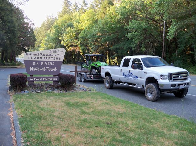
With the demand for backcountry OHV touring opportunities growing each year, QWR wants to highlight several NEW SxS and ATV riding options in Del Norte County on public lands within the Smith River National Recreation Area (NRA) on the Six Rivers National Forest.

View from CR 405 

The NRA is unique since the county road network functions as the only connector route for many of the designated Forest Service level 2 roads and trails. 

Forest Road 18N17 at CR 316 Intersection


Over the last few years, BRC, QWR, and the CA OHMVR Division, has been working with Del Norte County Supervisors and planning staff on ways to enhance legal OHV recreation in the Smith River area.  Those efforts were largely centered on the county designating 82 miles of their non-paved county roads as “non-highways” pursuant to CVC Section 38001.  Those non-highway designations were made by the county in November 2014.

CR 405 Mile Marker

 
2014 Del Norte County Non-Highway Resolution

If you have not ridden in this remote part of California, you are missing a real adventure that takes you back in time to when many of these routes were primary access roads in the 1800s.  This area has a rich mining history.

Old Gunpowder Magazine

The NRA is also home to many streams and much of the Smith River which is a prize fishing stream during the late summer and fall seasons.  During the hot summer months, many of these waterways have great swimming holes where you can cool off after a long days ride.

County Roads 314, 315, 316 Loops

For those who might be interested in taking a SxS or ATV adventure tour of this area, QWR would like to offer some suggestions for the northern loop which goes into Oregon and then back into California.

Patrick Creek Lodge

A great staging area(s) for several days of riding is at Patrick Creek Lodge where they have comfortable rooms and great dining.  If you want to camp, there is the Forest Service Patrick Creek Campground just across the highway from the lodge.  A refreshing swimming hole is close by for that after ride cool down.


Just across the bridge from the lodge, there is Patrick Creek Road (County Road 316 – Pink).  There is a staging area just across the bridge but there is a larger day staging area about 1 mile up the road on the left.  Also, there are numerous dispersed campsites along the creek.

Patrick Creek Campground


Follow CR 316 north to Forest Road 18N17 (Yellow) and ride out to the end of Monkey Creek Ridge (18N17 is seasonally open June 15 to October 15). Come back out to CR 316 and take a right and head north until you T into Forest Road 4402 (Blue).  Turn left on 4402 for a few miles and watch for a 4402 carsonite sign on the left.  Go left and you will be on the Wimer Road.

NRA District Ranger (L), David Palmer, Reviews Map of Area
with Local OHV Leaders

Forest Road 4402 is in the Rogue-Siskiyou National Forest.  QWR has confirmed with the Forest that the “blue” portion of 4402 is open for OHV use. 

FS Road 4402 to Diamond Creek/Wimer Road


The Wimer Road is a rocky 4WD route that will take you past Forest Road 18N09 (Diamond Creek – Yellow) and over to CR 305.  The 305 will take you past some great views of the mountains and the coast.  When on the 305 don’t forget to stop at the Stone Corral and enjoy what used to be a resting point for wagon trains and stage coaches.

Wimer 4WD Road

Another trip for your SxS or ATV is the French Hill/Hurdygurdy Creek loop which consists of CR 411 and 405.  QWR recommends that you stage from the Big Flat area where there is a large parking area.  The Yellow Routes are FS level 2 roads open for OHV use.

Wild Azalea

Both areas contain many vistas and potential dispersed camping opportunities.  Set aside plenty of time to explore the country.

Old Stone Corral

It is important to remember that the NRA is still waiting for the Record of Decision (ROD) on the newest round of travel management to be published sometime later this year.  QWR and others are hopeful that it will include additional OHV routes that will complement the county non-highway road system. The county is also working to enhance its signing program.

View of Lake Earl from CR 305

Be sure and stop by the Gasquet Ranger Station and pick up the most recent MVUM.

NRA Ranger Station

If you would like higher resolution PDF files of the two areas, please send a request to: damador@quietwarriorracing.com


Monday, July 6, 2015

ADVENTURE RIDERS - Take the Smith River NRA Adventure Challenge

Top End of Elk Camp Ridge Trail

After meeting a KTM 990 on the Wimer Road last week while working on a backcountry OHV touring project, QWR thought it was appropriate to share a great Adventure/Dual Sport opportunity with our readers.  The routes are on the Smith River National Recreation Area (NRA) which is located on the Six Rivers National Forest in the Northwest corner of California.

The Wimer Road


If you have not ridden in this remote part of California, you are missing a real adventure that takes you back in time to when many of these routes were primary access roads in the 1800s.  This area has a rich mining history. 


The NRA is also home to many streams and much of the Smith River which is a prize fishing stream during the late summer and fall seasons.  During the hot summer months, many of these waterways have great swimming holes where you can cool off after a long days ride.

Old Powder Magazine from Mining Operation


For those who might be interested in taking an adventure tour of this area, QWR would like to offer some suggestions for the northern loop which goes into Oregon and then back into California.

Forest Road 18N17


A great staging area(s) for several days of riding is at Patrick Creek Lodge where they have comfortable rooms and great dining.  If you want to camp, there is the Forest Service Patrick Creek Campground just across the highway from the lodge.  A refreshing swimming hole is close by for that after ride cool down.

Patrick Creek Lodge


Just across the bridge from the lodge, there is Patrick Creek Road (County Road 316 – Pink).  Follow CR 316 north to Forest Road 18N17 (Yellow) and ride out to the end of Monkey Creek Ridge.  Come back out to CR 316 and take a right and head north until you T into Forest Road 4402 (Blue).  Turn left on 4402 for a few miles and watch for a 4402 sign on the left.  Go left and you will be on the Wimer Road.


The Wimer Road is a rocky 4WD route that will take you past Forest Road 18N09 (Diamond Creek – Yellow) and over to CR 305.  The 305 will take you past some great views of the mountains and the coast.

View of Lake Earl


If you have enough energy for day two, there are a couple of A/B enduro skill-level motorcycle only trails that will test your ability.  The Elk Camp Ridge Trail and High Dome Trail are marked in red.  QWR would suggest that you plan (using CR 315) your day so that you go DOWN those routes instead of climbing them. 


WARNING – many of these routes are for experienced adventure/dual-sport riders only.


Enjoy your summer and let QWR know if you take the NRA challenge.